Hernani
Hernani is a fifth class municipality in the province of Eastern Samar, Philippines. According to the 2015 census, it has a population of 8,573 people.
It was formerly called Nag-as, after the name of the river flowing southeast of the town center. Hernani is politically subdivided into 13 barangays. Four barangays, located in the poblacion, are known primarily by number: The population of Hernani in the 2015 census was 8,573 people, with a density of 170 inhabitants per square kilometre or 440 inhabitants per square mile.
References
Mayor: Edgar C. Boco
Vice-Mayor: Wilmar S. Candido
SB Members:
Barangays
Demographics
Population census of Hernani
Year
Pop.
±% p.a.
1903
4,150
—
1918
5,253
1.58%
1939
9,405
2.81%
1948
5,035
−6.71%
1960
6,622
2.31%
1970
6,216
−0.63%
1975
7,315
3.32%
1980
7,032
−0.79%
1990
6,840
−0.28%
1995
8,055
3.11%
2000
7,642
−1.12%
2007
7,974
0.59%
2010
8,070
0.44%
2015
8,573
1.16%
Source: Philippine Statistics Authority
Hernani |
|
|---|---|
| Municipality | |
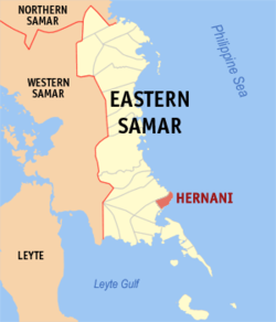 Map of Eastern Samar with Hernani highlighted |
|
|
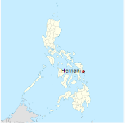
Location within the Philippines |
|
| Coordinates: 11°20′N 125°35′E | |
| Country | Philippines |
| Region | Eastern Visayas (Region VIII) |
| Province | Eastern Samar |
| District | Lone district of E. Samar |
| Established | 1926 |
| Barangays | 13 |
| Government | |
| •Mayor | Edgar C. Boco |
| Area |
|
| • Total | 49.42 km2 (19.08 sq mi) |
| Population (2015 Census) |
|
| • Total | 8,573 |
| • Density | 170/km2 (450/sq mi) |
| Time zone | PST (UTC+8) |
| ZIP code | 6804 |
| IDD : area code | +63 (0)55 |
| Website | hernani-esamar |

Hernani – Places to Go
Other Places to Go
- The Christmas festivities at the Capitol has begun with the switching on of the Christmas Tree at the Capitol grounds as the highlight of ceremony.
- The Department of Agriculture Regional Office No. VIII and the Province of Eastern Samar, on Friday, December 2, broke ground for the the Improvement/Concreting of Brgy. Burak-Mabuhay-Bantayan-Kalaw Farm To Market Road in Oras, E. Samar.
- Provincial Government’s Financial Assistance in Barangay Cambilla, Quinapondan Eastern Samar
- Dumpao Beach Resort
- The Surf Camp Resort at Calicoan Island
- Yolanda Beach
- Headland / Promontory and Bay / Cove
- Sanizi Falls
- A Steel Hanging Bridge
- Menasnge Beach
- Virgin Del Remedios Parish Church
- St. Joseph’s Church
- Dangkalan Pacific Beach Resort
- Linao Cave
- Paninihian Sunrise View Pacific Resort
- Manicani Island
- Brgy. Tikling Beach
- Apiton Island
- Municipal Hall of Arteche
- The Township/Parish
- Ulot River
- Ban-awan Falls
- Jagnaya Beach
- Minasangay Eco Park and Resort
- Canhugas Nature Park
- Barangay’s Wayback in 2006
- Katican Island
- Divinubo Island
- Lovely Ogis Island
- Immaculate Conception Parish Church